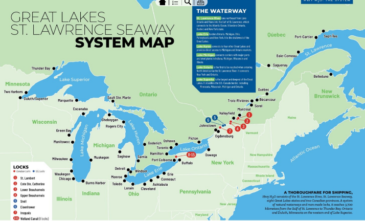
The Great Lakes St. Lawrence Seaway (GLSLS) is a 3,700 kilometer (2,400 mile) marine highway that provides international and domestic vessels access to over 40 Canadian and U.S. ports across the St. Lawrence river and the five Great Lakes. [1]


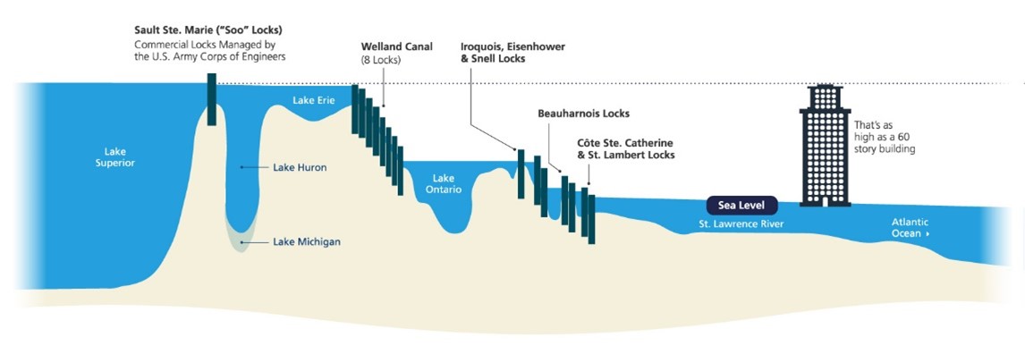
There are two series of locks a vessel may transit depending on their port call in the Great Lakes. The first set of locks occur between the St. Lawrence River and Lake Ontario and the second set of locks make up the Welland Canal, which provides access to Lake Erie from Lake Ontario and vice versa. These Seaway locks are operational from the middle of March until the first week of January every year. Managed as a bi-national operation between Canada’s St. Lawrence Seaway Management Corporation and the U.S. Saint Lawrence Seaway Development Corporation, the locks are supported by a toll-fee structure. The Soo Locks, having made the St. Mary’s River navigable, connect Lake Superior to the lower four Great Lakes and the St. Lawrence Seaway and are operated and managed by the U.S. Army Corps of Engineers.
The Seaway locks allow vessels that are a maximum of 225.5 meters (740 feet) in length, 23.8 meters (78 feet) wide, and with an 8.08meters (26.6 feet) draft. [2] [3]

Typical cargoes that transit the Great Lakes include:
- Breakbulk cargoes: steel (coils, slab, beams), machinery
- Project cargoes: wind blades and transformers
- Dry bulk: grains, aggregates, fertilizers,
- Liquid bulk: petroleum products, biofuels
- Containers: an emerging market
[1] Great Lakes Map
[2] Locks, Canals, and Channels
[3] Vessel Types